

Routes
Spirit Xtreme Triathlon
May the 4th be with you
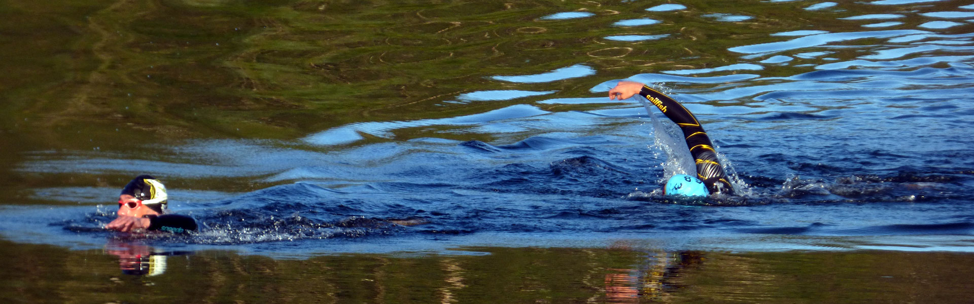
Swim
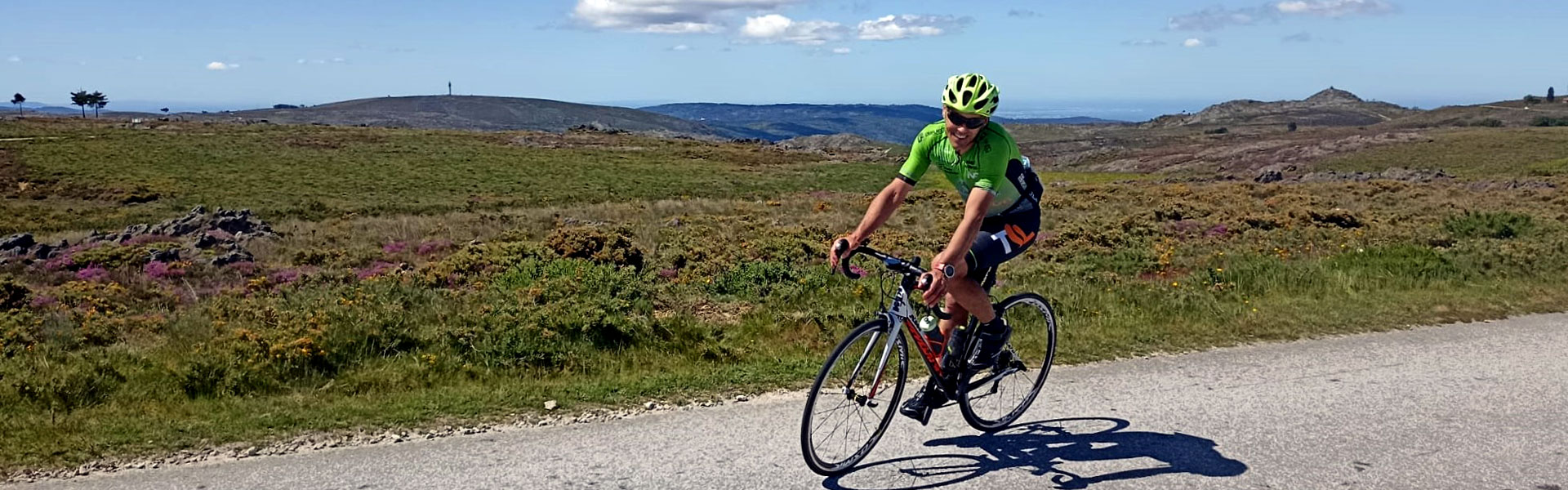
Bike

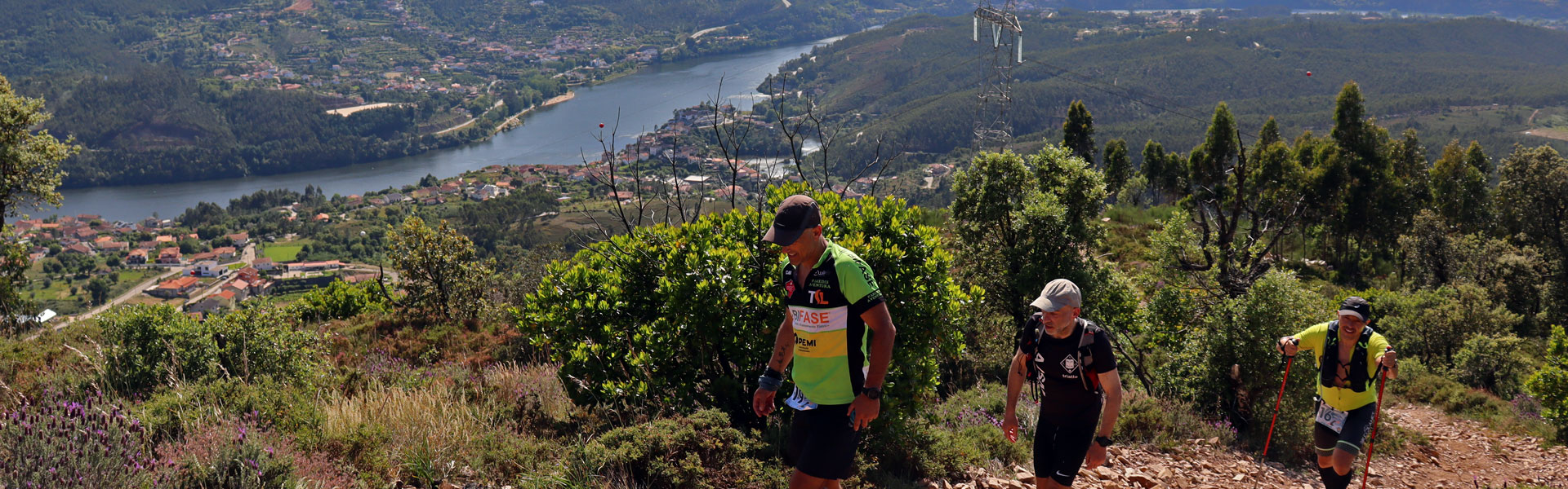
Run
Spirit Xtreme
Swim
2000m (1.24mi)
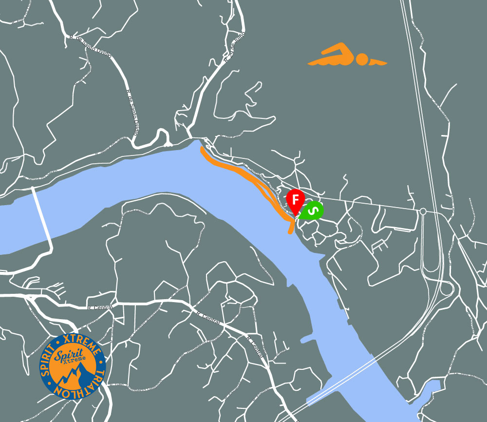
Swimming will be the easiest part of the race. It takes place in the calm waters of the Crestuma dam, with the water temperature already very comfortable. It will be a good warm-up for what comes next.
The race starts next to the water access ramp, which exists in the eastern part of the Lixa pier.
Athletes have to swim 1000m along the bank, towards the dam, go around a buoy and return to the right, a little further from the bank.
The water exits via the access ramp that exists there.
The transition park is next to the water access ramp.
For safety reasons, the use of neoprene is recommended for all athletes.
Bike
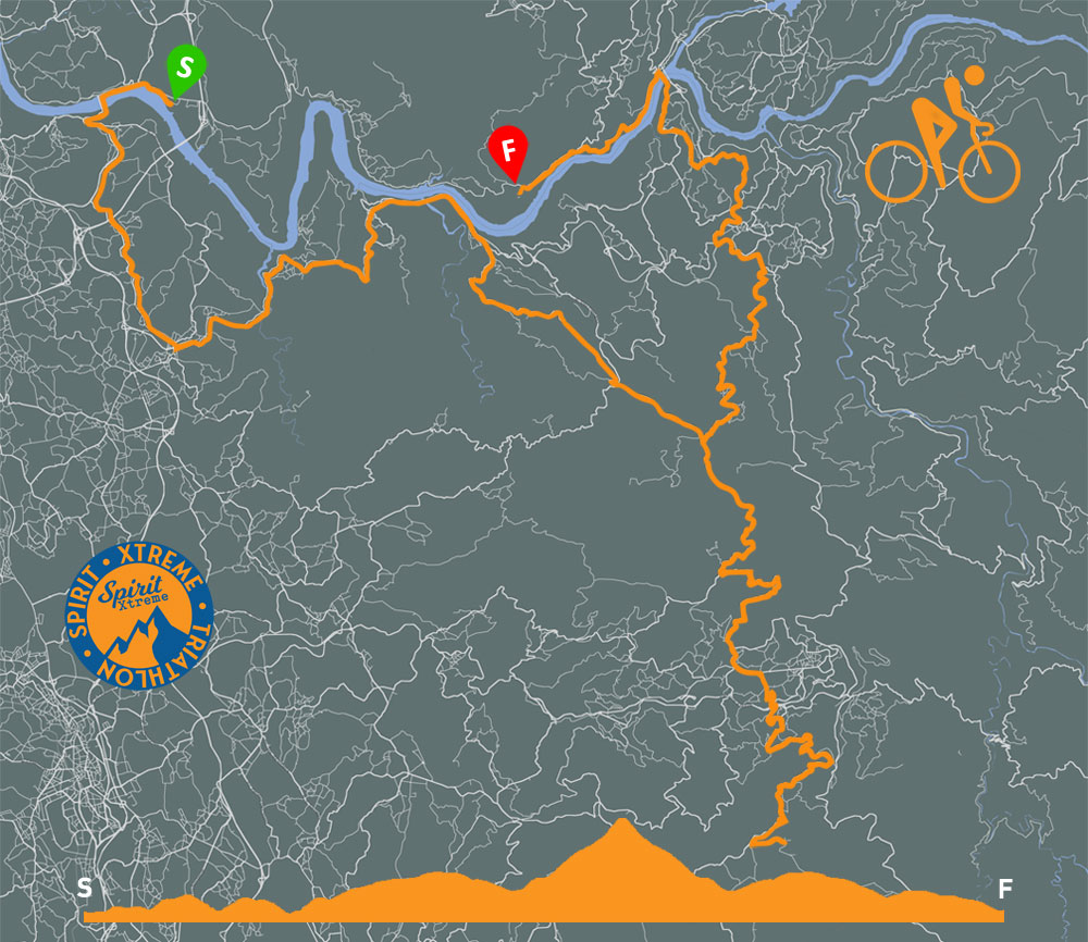
Course of 120km (74.6mi) - 2300m (1.43mi) positive uphill
Cycling takes place with the road open to traffic. Athletes are required to drive within the rules of the highway code.
The cycling route is not marked, so athletes are required to carry GPS navigation devices, which can be bicycle computers or smartphones.
The cycling route is easy to navigate, with few road change points.
Cycling starts towards the main road, at the roundabout go west and 2km later turn left towards the dam. After two climbs (km 6,6) turn left towards Lomba/Canedo. Continue until a large roundabout appears (km 12), enter and gooutin the third exity, onto the N222 road, towards Castelo de Paiva/Lomba.
Follow the N222 until Pedorido, a roundabout appears at km 27.5, continue for another 50m and turn right. 2 roads appear, follow the route that goes left, going up, towards Arouca. Continue until km 36, when a new roundabout appears. Take the second exit, towards Castelo de Paiva, a few meters ahead on the new roundabout, take the second exit towards Arouca.
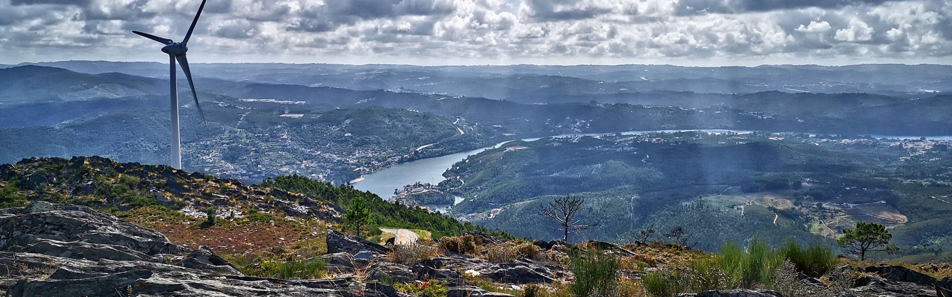
At km 39.5, go straight ahead and join the road that goes towards Arouca. After a long descent you reach Arouca (km 52), at a roundabout, take the second exit towards the center of the city. 500m ahead, turn right towards Serra da Freita. Go up 12km to the highest point, next to the wind farms (km 65), when a junction appears, turn left towards Detrelo da Malhada/Miradouro. The supply and return point is 1km ahead.
The return is via the same road, towards Arouca. At the end of the descent a junction appears (km 80), turn left and at the roundabout take the first exit towards Castelo de Paiva. Continue along the road until you reach a roundabout (km 102,5), at the gates of Castelo de Paiva. Take the third exit, towards Cinfães/Entre-os-Rios/Gaia/Feira and 1km ahead turn right towards Cinfães/Clo Paiva/Entre-os-Rios/Penafiel. Go another 1km to a new roundabout, taking the 2nd exit for Porto/Entre-os-Rios/Penafiel/Cinfães. The third roundabout in the area appears, and here take the second exit towards Porto/Entre-os-Rios/Penafiel.
Now go down to Douro, with a last cut on the left before the river (km 112), towards Porto/Entre-os-Rios. Cross the river and at rounda (km 113) head west towards Porto. The cycling ends at km 120, in Sebolido.
The tracks will be made available to all athletes, so that they can install them on their devices and, if possible, test them. In addition to the GPS tracks, a brief description of the road change points will be made available.
Run
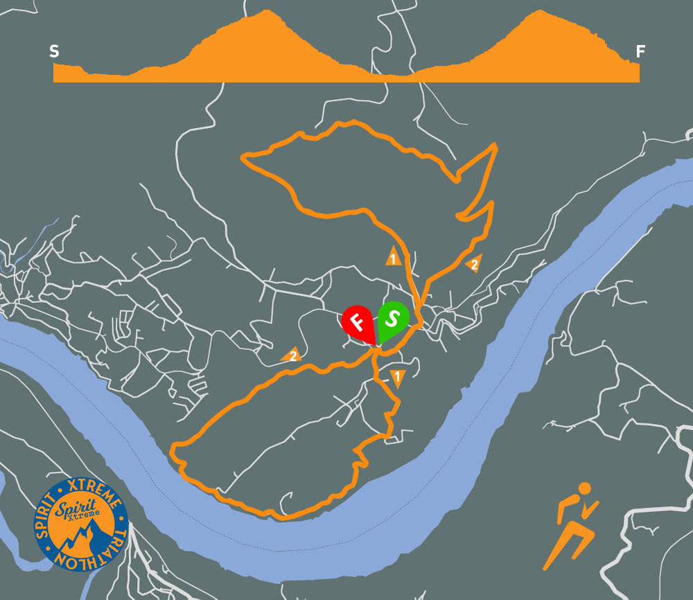
Course of 19km (11.8mi) - 1000m (0.62mi) positive uphill
The Run segment takes place on trail trails, on the slopes of Serra da Boneca, on an existing route, the PR5, which is marked with the symbols normally used in this type of walking route.
In addition to the official route markings, the organization will place its own signage to facilitate navigation for athletes.
The route will consist of two laps in the shape of a figure 8, with the center from figure 8 being the beginning, fueling and end of the race.
The race starts towards the river, along the route on the left. Arriving at the supply area athletes must begin to climb along a parallel road, common to the ascent and descent. Around 500m from there there is a fork and you have to follow the trail on the left, which takes athletes to the top of the mountain, next to the wind farms, returning along the trail on the right.
Athletes will have to do the first lap of the route in one direction and in the second the direction reverses, in order to force athletes to pass athletes running in the opposite direction.
Thus, the second lap also starts towards the river, but along the trail on the right. When going uphill you have to follow the trail on the right, towards the swing.
The run segment is done on a trail and is 19km (11.8mi) long, with 1000m (0.62mi) of positive accumulation.